|
|||
|
|
House of Representatives Standing Committee on Climate Change, Water, Environment and the Arts
Navigation: Previous Page | Contents | Next Page Chapter 3 Climate change and the coastal zone: adaptation strategies and practices to promote resilienceadaptation is a long-term agenda and it will take time to quantify risks of climate change impacts and to build capacity to minimise costs and to take advantage of any benefits.[1] Introduction3.1 Chapter 3 focuses on the Committee�s terms of reference to investigate the impact of climate change on coastal areas, with particular emphasis on climate change adaptation. Adaptation is defined in the Council of Australian Governments (COAG) National Climate Change Adaptation Framework as �the principal way to deal with the unavoidable impacts of climate change. It is a mechanism to manage risks, adjust economic activity to reduce vulnerability and to improve business certainty�.[2] 3.2 Australia is in the very early stages of adapting to climate change. As the National Climate Change Adaptation Framework notes �adaptation is a long-term agenda and it will take time to quantify risks of climate change impacts and to build capacity to minimise costs and to take advantage of any benefits�.[3] 3.3 Chapter 3 looks at the National Climate Change Adaptation Framework and major initiatives as part of the National Coastal Vulnerability Assessment or �first pass� assessment. It also discusses a number of federal climate change adaptation programs, and the role of state and local government in climate change adaptation in the coastal zone. The chapter then provides an overview of climate change adaptation issues for a range of sectors relevant to the coastal zone, such as water resources, health, industry, disaster management and infrastructure. The chapter concludes with a discussion on coastal Indigenous communities and climate change adaptation. COAG National Climate Change Adaptation Framework3.4 The National Climate Change Adaptation Framework, endorsed by COAG at its meeting on 13 April 2007, was designed to provide a nationally consistent focus for climate change adaptation action for the next five to seven years.[4] 3.5 The framework rests on the acknowledgment that, regardless of mitigation action undertaken with respect to reducing greenhouse gas emissions, changes to the climate are already observable and in order to minimise their impacts in Australia, a coordinated strategy for adapting to them is required. 3.6 The Australian Standard for Risk Management (AS/NZS 4360: 2004) provides a generic framework for identifying, analysing and communicating risk. This standard has been adopted throughout Australia.[5] As the Victorian Department of Sustainability and Environment noted: Whilst there is some variation in methodologies used by agencies to assess risk, recent models developed to better understand the coastal impacts of climate change have drawn on both the national standard AS/NZS 4360:2004 and on national policy frameworks and risk methodologies. In this sense there is some degree of consistency but importantly there has also been modification of standardised methodologies to accommodate local circumstances and specific planning exercises.[6] 3.7 The National Climate Change Adaptation Framework establishes principles for understanding and building on Australia�s adaptive capacity and highlights themes that are identified as priority areas where vulnerability to climate change impacts should be reduced. 3.8 The following themes are identified under the framework for reducing sectoral and regional vulnerability to climate change:
3.9 As the only regional priority area amongst a list of sectoral themes, �coastal regions� is relatively incongruous in the list. The coastal zone is at risk not only from the direct impacts of climate change on the environment but also from the threats to all other identified priority areas. As such, adaptation work in other areas is also significant with respect to the coast. This chapter will later examine adaptation work being carried out with respect to the other themes identified in the framework, as relevant to the coastal zone. Coastal adaptation in the National Climate Change Adaptation Framework3.10 The National Climate Change Adaptation Framework identifies that coastal regions are: vulnerable to sea level rise, increased sea surface temperature, increased storm intensity and frequency, ocean acidification and changes to rainfall, run-off, wave size and direction and ocean currents.[7] 3.11 The framework notes that the threats to the coastal zone from climate change are intensified by the significance of the zone to Australia more generally. Coastal regions incorporate the most densely populated areas of the country�holding the vast majority of our population, infrastructure and industry.[8] 3.12 The framework recognises the need to assess the vulnerability of Australia�s coastal zone, so that effective adaptation strategies can be implemented, and calls for nationally consistent action on this assessment. National Coastal Vulnerability Assessment�the �first pass� assessment3.13 The National Coastal Vulnerability Assessment (NCVA) or �first pass� assessment is being undertaken by the Department of Climate Change in response to the National Climate Change Adaptation Framework�s call for a national vulnerability assessment. The �first pass� NCVA is designed to:
3.14 The results will ensure a clearer picture of the level of vulnerability around Australia�s coastline. This will provide a coordinated, national representation of Australia�s coastal vulnerability from which more localised decisions can be made with regard to adaptation.[9] The work is being undertaken to address the current shortfall in information regarding our coastal vulnerability. The Department of Climate Change�s submission to the inquiry noted that: The current �first pass� National Coastal Vulnerability Assessment (NCVA) of key assets within Australia�s coastal zone will begin to address our knowledge deficit. The NCVA will provide the first, whole of nation understanding of the magnitude and spatial extent of risk and will drive the national development of essential tools for climate change adaptation.[10] 3.15 The Department of Climate Change website states the three aims of the assessment as being:
3.16 The department identifies the components of the first pass assessment as follows:
Digital elevation modelling3.17 A digital elevation model (DEM) provides a digital depiction of the topography and elevation of terrain. Digital elevation modelling is used in assessing coastal vulnerability to sea level rise. 3.18 The Department of Climate Change is undertaking two DEM projects under the NCVA:
National Elevation Data Framework3.19 The Department of Climate Change, through the Spatial Information Council (ANZLIC),[12] is working to develop a mid-resolution DEM for the entire Australian coastline through the establishment of a National Elevation Data Framework (NEDF). 3.20 To date, DEM work has been undertaken in isolation by local and state governments or for specific projects, without any method for sharing this information nationally. The NEDF will allow all this modelling, as well as modelling undertaken in the future, to be more widely available in one place. As representatives of the Department of Climate Change explained to the Committee: the issue is to try to get all of the state, territory and local governments on board with this process so that all the work that they do is consistent with this framework and can be integrated into the framework.[13] 3.21 ANZLIC is producing a set of tools or specifications that will allow data collected from future DEM work by state, territory or local governments to be consistent with the framework so that the data will be more widely available. In evidence to the Committee, departmental representatives described the proposed NEDF as follows: If you think about something like Google Maps, for example, you are able to look at the data and slowly drill down through the data layers until you get more and more resolution. That is the intention.[14] 3.22 The data available from the NEDF will be mid-resolution (five to 10 metres). This mid-resolution DEM is designed to give consistent coverage of the whole of Australia. However the department admits that this model will �not give us the level of detail we need in terms of elevation rise�.[15] 3.23 The Committee welcomes the NEDF initiative, as it will allow for greater national consistency. The availability of an overall picture of the topography of Australia�s coastline will be highly valuable. The Committee notes, however, that this mid-resolution modelling is not to the resolution quality required for local application. The Committee also notes the concerns raised by Engineers Australia relating to the NEDF, including:
High-resolution urban DEM3.24 The second DEM project that the Department of Climate Change is undertaking as part of the NCVA is a high-resolution urban DEM. This will map the vulnerability to inundation of priority urban areas in the coastal zone. The CRC for Spatial Information was commissioned in June 2008 to compile all the high resolution DEM data for major Australian cities (all of which are located in the coastal zone) into a framework. Initial work will focus on Perth, Adelaide, Sydney, Brisbane, Melbourne, the Gold Coast and the NSW Central Coast. The Committee understands that the CRC is: buying access to existing datasets and recompiling those datasets so that they are consistent with this framework. Those datasets will be available publicly to all levels of government for non-commercial purposes.[17] 3.25 The Committee draws attention to the need for this information to be made available and accessible to key stakeholders. This data will be of particular assistance in shaping local adaptation plans. National shoreline mapping: the �Smartline� project3.26 Another significant element of the first pass assessment is the mapping of Australia�s coastal geomorphology. The National Coastal Landform and Stability Mapping tool (dubbed the �Smartline� project), released on 4 August 2009, was undertaken in collaboration between the Department of Climate Change and Geoscience Australia. The mapping tool visually displays the geology of Australia�s coastline, allowing for better understanding of the vulnerability to climate change impacts. So-called �softer� geology is more susceptible to coastal erosion than �harder� geology, and therefore the vulnerability to climate change impacts of these areas of the coast is greater. The department explained: We are collecting information on the littoral and sub littoral zones�so just off the beach and also behind the beach up to 500 metres. We are interested in knowing, for example, what is behind the beach. If it is a low-lying flat plain, it would be easily flooded; if it is a sequence of high dunes, it is better protected.[18] 3.27 The Smartline project, for the first time, provides an entire geomorphic map of the Australian coastline. The project was undertaken under contract at the University of Tasmania, coordinated by Mr Chris Sharples. The submission to the inquiry from the University of Tasmania sets out the value of a National Coastal Landform and Stability Mapping tool: whilst a great deal of relevant geological, geomorphic, topographic and other mapping exists for the Australian coast, this mapping has been prepared for various parts of the coast in numerous different formats, for different purposes, at different scales and using different classifications. There is no one nationally-consistent geomorphic map of the Australian coast suitable for sensitivity assessment, except at scales too coarse to be of real use. This meant it would be very difficult and confusing to consistently assess coastal vulnerability at a national level using the hundreds of disparate data sets in existence. The �Smartline� project has been undertaken ... to remedy this problem by combining several hundred relevant mapped datasets into a single nationally-consistent map, using a mapping format previously trialled successfully in Tasmania.[19] 3.28 On announcing the completion of the mapping tool in August 2009, the Minister Assisting the Minister for Climate Change, the Hon Greg Combet, said: The mapping tool contains detailed coastal landform information, so it will be of immediate benefit to local planners and decision makers as they make coastal planning decisions.[20] 3.29 The Committee commends the Australian Government for its work on this important mapping tool, and believes that it will be of great significance in better assessing national coastal vulnerability. Greater understanding of the geological make up of the coastline will also allow better understanding of the risks involved when making planning decisions in the coastal zone. (Planning issues will be discussed in more detail in Chapter 4.) 3.30 The Committee believes this important mapping tool could be better presented and made more accessible and useful to a range of stakeholders. At present, the Smartline maps are hosted on the OzCoasts website.[21] The website offers very limited explanation of the purpose of the maps, and the instructions are difficult to find and assume prior knowledge.[22] The National Climate Change Adaptation Framework highlights the need for not only national coordination of vulnerability data but also effective communication of that data so that best practice adaptation decisions can be made nationally. 3.31 Mr Sharples, in evidence to the Committee, noted the importance of moving beyond the first pass assessment to more detailed second and third pass assessments: once you have looked at where the soft parts of the coast are�which is the first pass�and where the wave energy is likely to cause erosion�which is the second pass�then, at the next most detailed level�what I call the third pass, which is looking at all the other local variables.[23] 3.32 In terms of the second pass assessment, Mr Sharples further commented that: we should have a look at how the wave climate nationally interacts with those landform types and model the wave climate around the coast to pick the real hot spots.[24]
Assessing the vulnerability of coastal biodiversity3.34 A further component of the NCVA is an assessment of the impacts of climate change on biodiversity in the coastal zone. CSIRO is establishing a coastal/marine ecosystems vulnerability framework assessment. The assessment will analyse nine habitats, covering geomorphic (beaches, estuaries, wetlands), supratidal (dune vegetation, mangrove, saltmarsh) and subtidal (sea grass, coral reef, macroalgae) habitats. The framework assessment will use indicators regarding exposure, sensitivity and adaptive capacity which have been developed to create a vulnerability index for each habitat. 3.35 The Committee is pleased to see an assessment of the impacts on biodiversity as an element of the first pass assessment, although it did not receive a great deal of evidence on this particular study. The impact of climate change on biodiversity is discussed in more detail in Chapter 5. Case studies3.36 The last major element of the NCVA is the six case studies. Six different geographical locations around Australia�s coastline have been selected for analysis, each to examine particular impacts of climate change on the various coastal environments. The locations selected will provide information regarding specific climate change impacts on activities which occur in the coastal zone. The case studies are as follows:
3.37 The Committee observes that the six projects will provide a broad scope of data regarding the regional variances in Australia�s coastal vulnerability with respect to various economic and social impacts of climate change. Australian Government and coastal climate change adaptation programs in the coastal zone3.38 Of interest to the Committee was the range of national climate change adaptation programs in the coastal zone. The corporate plan for the Department of Climate Change sets out the three �pillars� under which the department operates, including �adapting to the impacts of climate change we cannot avoid�.[25] The Australian Government administers four programs and facilities in relation to climate change adaptation:
Climate Change Adaptation Skills for Professionals Program3.39 The Department of Climate Change administers the Climate Change Adaptation Skills for Professionals Program, which provides small grants to tertiary education and training institutions as well as professional associations, to revise or develop professional development and accreditation programs for architects, engineers, natural resource managers and planners. This program acknowledges the crucial role these professions will play in supporting Australia�s capacity to adapt to the impacts of climate change. The Committee commends the government�s support of these important professions via this program, and would like to see continued support. The initial round closed in December 2007, with successful applicants announced in May 2008.[26] The Committee notes that the department�s website has no information as to whether a second round of funding will take place under the program. 3.40 A number of inquiry participants raised the issue of a shortage of coastal planners and engineers and the consequences of this for ensuring robust climate change adaptation strategies for the coast in the future: I would make the point that we do need to think about how we will train up professionals or existing professionals with ongoing professional development to deal with these issues in the future ... I could name on one hand how many courses there are in Australia in coastal planning. Similarly, I have heard from the engineering institute that there is a critical shortage of coastal engineers. If we do not have any coastal planners or coastal engineers in the context of planning for climate change on the coast then we have a looming skills problem in the future.[27]
Local Adaptation Pathways Program3.42 The Department of Climate Change also administers the Local Adaptation Pathways Program (LAPP) which provides funding for local governments to undertake climate change risk assessments at the local level and develop action plans so that results of assessments may be integrated into broader decision-making to thereby build regional capacity to respond to the impacts of climate change.[28] 3.43 In order for effective climate change adaptation to take place, detailed local vulnerability assessments will be required. The Committee strongly supports the Australian Government�s Local Adaptation Pathways Program. As noted by the Sydney Coastal Councils Group (SCCG), the program �offers Local Government the opportunity to identify, trial and implement adaptation actions within a risk management framework.�[29] During the course of the inquiry, constructive suggestions were made to strengthen the program�s outcomes. 3.44 The Local Government Association of NSW argued that information sharing should be made a formal requirement for funding under the program: Ideally, funding for adaptation action plans should be delivered in such a way as to promote dissemination of the learning and experiences gained from preparing the plans and to promote a regional approach to adaptation planning. The Local Adaptation Pathways grant application required applicants to �Demonstrate a commitment to provide and share information relevant to the process.� We respectfully suggest that such information sharing should involve a formal, organised dissemination of the outputs and outcomes of the grant funded projects and the sharing of experiences with processes employed during the projects. � Without such dissemination there is a danger of duplication of effort, and sub-optimal use of time and resources across councils and communities and a risk that key areas for attention could be overlooked. Conversely, sharing information and insights can lead to more effective, efficient and innovative outcomes for other projects.[30] 3.45 As well as the issue of disseminating and sharing information, concern was expressed about possible fragmentation of outcomes in the absence of a strategic approach to these assessments. Mr Townsend, Immediate Past Chair of the National Committee on Coastal and Ocean Engineering from Engineers Australia, commented that: Fragmentation is a serious concern. We are seeing overlap in tasks that are being conducted. We are also seeing a non-strategic approach being taken in some levels.[31] 3.46 A further concern is that the Local Adaptation Pathways Program does not call for standardised approaches in climate change vulnerability assessments. Councils are not required to undertake any specific assessments with the funding they receive. The Department of Climate Change acknowledged this in evidence to the Committee: there would be value in trying to give them some standardised approaches to conducting risk assessments in local government.[32]
National Climate Change Adaptation Research Facility3.49 The National Climate Change Adaptation Facility (NCCARF), established in 2007, is a collaboration of academic facilities addressing broad issues of adaptation from a research perspective. It is hosted by Griffith University, with funding from the Department of Climate Change. NCCARF leads the national interdisciplinary research effort to �generate the information needed by decision-makers in government and in vulnerable sectors and communities to manage the risks of climate change impacts.�[33] 3.50 The National Climate Change Adaptation Framework identified a need for the establishment of a body that would coordinate Australia�s research resources to produce targeted research to assist in adaptation decision making, which led to the establishment of NCCARF. 3.51 NCCARF outlines its key roles as:
3.52 NCCARF will produce a research plan on various themes. Each plan will be produced by a network of academics coordinated by various research bodies, as follows:
3.53 The work of the NCCARF is supported by the Committee. At the time of writing only the health research plan[36] has been finalised and released by NCCARF and announced by the Minister for Climate Change.[37] The Committee looks forward to the release of further plans. 3.54 The Committee was surprised to learn that there is not a coastal research network within NCCARF. Most of the other themes highlighted in the National Climate Change Adaptation Framework are covered by the work of the research facility. This omission should be rectified.
CSIRO�Climate Adaptation National Research Flagship3.56 CSIRO has established the Climate Adaptation National Research Flagship to address the national challenge of climate change adaptation in Australia. The flagship is working to develop adaptation responses to counter the expected effects of climate change in Australia and deliver strategies to manage their impact, as well as develop new ways to combat and potentially benefit from these challenges.[38] 3.57 Research at the flagship is being conducted under four themes designed to help increase Australia�s adaptive capacity. They are:
3.58 Under the �Sustainable cities and coasts� theme, the flagship is addressing climate change adaptation in the coastal zone. The flagship�s website states that: Researchers are developing planning, design, infrastructure and management solutions to help Australia's cities and coasts adapt to a changing climate.[39] 3.59 The Committee is pleased to see this scientific focus on adaptation in Australia�s coastal zone, and believes there is a great need for further scientific engagement in developing Australia�s coastal adaptive capacity. Role of state and local government in climate change adaptation in the coastal zone3.60 State and local governments play a vital role in climate change adaptation. The COAG National Climate Change Adaptation Framework states that: risks should be managed by those best equipped to understand the context and likely consequences of action, and there is a clear need to build capacity at local and regional scales. There is an important role for business and the community in addressing climate change risks, and governments will pursue a partnership approach to adaptation to manage risks and identify any opportunities.[40] 3.61 As Mr Sharples explained, there are significant factors of �regional and local variability� such as �climactic, oceanographic, geological, geomorphic and topographic factors� that define the Australian coastal zone and will significantly determine the regional impacts of climate change around the coast.[41] The Committee strongly endorses the framework�s statement that adaptation is most effectively carried out by those best placed to do so. 3.62 The Committee notes that the first pass NCVA will provide a broad national vulnerability assessment of the Australian coast, with a selection of more in depth analyses of the local impacts of climate change drawn from the six case studies. 3.63 The Committee believes that it is these more detailed, localised assessments of the coastal zone that will be of greatest value into the future. The Committee also notes the Integrated Assessment of Climate Change Impacts on Human Settlements and Infrastructure initiative being funded in part by the Department of Climate Change, in collaboration with state, territory and local governments, as well as research institutions and local communities. Case studies have taken place in Western Port, Victoria; Clarence, Tasmania; Gold Coast, Queensland and Sydney, NSW.[42]
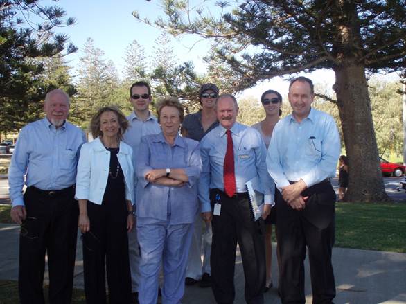
Committee members with Town of Cottesloe council officials at a site inspection of Cottesloe foreshore, WA 3.64 The study entitled, �Three pass approach to coastal risk assessment,� highlights the need not only for a first pass assessment which establishes coastal �sensitivity� to climate change impacts but also for second and third pass assessments. These further assessments involve looking at the �exposure� of different regions of the coast to the impacts of climate change (second pass) and then undertaking site-specific assessments of vulnerable locations (third pass).[43] The Committee is aware that a large number of coastal councils and state governments are already undertaking their own vulnerability assessments, and have been doing so for some time. While it is beyond the scope of this report to consider these local coastal adaptation studies in detail, several that were drawn to the attention of the Committee during the inquiry are listed in Figure 3.1. 3.65 The Committee would like to highlight the Victorian Government�s �Future Coasts� project. They noted: Victoria is undertaking a major project, Future Coasts, to develop comprehensive vulnerability assessments for the whole Victorian coastline worth in excess of $8 million. This project will also develop planning and policy guidance and adaptation strategies for decision making. The Victorian State Government will be working closely with land managers and local government on this work.[44] 3.66 Through this project, the Victorian Department of Sustainability and Environment is collecting high resolution DEM data for both sea depth and topographic elevation�within a range of 20m below and 10m above sea level. The topographic DEM is currently available for the entire Victorian coastline.[45] �Future Coasts� also involves a coastal policy and planning project, focused on how planning and management of coastal areas could better incorporate the impacts of climate change. The project will involve engagement with coastal stakeholders to identify the policy and decision-making guidance needed to support better planning and management outcomes on the coast. The third element of �Future Coasts� is a coastal asset database that will seek to provide an inventory of the key assets and infrastructure located within the Victorian coastal zone.[46] Figure 3.1����� Examples of local coastal adaptation studies Sydney Coastal Councils, NSW The Sydney Coastal Councils Group (SCCG) received funding from DCC to commission CSIRO to work in collaboration with the University of the Sunshine Coast to undertake a 2 year research project on regional approaches to managing climate vulnerability in the Sydney region. The goal of the �Systems Approach to Regional Climate Change Adaptation Strategies in Metropolises� project was to explore climate change risk management, specifically in relation to climate change adaptation in the SCCG region. The project focuses on the capacity of the 15 SCCG member councils to adapt to climate change. The project involved the production of a report mapping the climate change vulnerability in the SCCG region.[47] Gippsland Coastal Board, VIC In 2005-06, commissioned CSIRO, with funding assistance from National Heritage Trust, to undertake three reports on impacts of climate change on weather patterns, storm surges, and extreme sea levels in Gippsland region.[48] The studies have been used to assist communities and coastal managers in understanding and preparing for more extreme storm events which are likely to occur in that region. The Board has also commissioned a final report which gives greater detail regarding the location of the most vulnerable communities and assets in the Gippsland region.[49] Lake Macquarie City Council, NSW One of the first local government areas to establish and implement coastline and estuary management plans based on draft NSW state government estuary and coastal management manuals. In 2008, council also resolved to exhibit a proposal to adopt a sea level rise figure for the year 2100 of 0.91m, based on NSW Department of Environment and Climate Change projected upper level sea level rise figure.[50] Tasmanian State Government In 2006, Chris Sharples released a report, commissioned by the Department of Primary Industries and Water, outlining the vulnerability of the Tasmanian coastline to the impacts of climate change and sea-level risk.[51] Subsequent to Sharples� report, the Tasmanian Government is conducting the Climate Change and Coastal Risk Assessment Project, to develop tools and resources to assist with risk-based management and planning for various assets and values in the coastal zone.[52] 3.67 The Australian Government intends to hold a �National Coastal Climate Change Forum� on completion of the first pass assessment.[53] The Department of Climate Change states that the forum will: bring together the key stakeholders and provide the information and tools so that the participants can develop a clear and consistent set of guidelines that coastal communities can use in adapting to climate change impacts.[54] 3.68 The Committee supports the involvement of coastal councils, local government associations and state governments in this forum, as dialogue between jurisdictions is paramount in ensuring the best coastal climate change adaptation guidelines are set. Mr Beresford-Wylie, ALGA Chief Executive, noting that there are several hundred coastal councils, observed that: Councils in a forum will be able to articulate exactly what it is that they, as individual councils, will be looking for, and there will be a whole variety of different experiences they put on the table. � Then, in a sense, it will hopefully be up to the Australian government to identify what it might do, and what it might contribute, in terms of helping councils address the issues that come forward.[55] 3.69 The Committee believes that a regional approach to climate change adaptation in the coastal zone is an efficient method of undertaking vulnerability assessments and implementing adaptation plans. Cooperation between local government areas can be particularly beneficial as the climate change threats to neighbouring areas are often similar and may be more efficiently addressed through a collaborative approach. 3.70 The Summary of Outcomes from the June 2009 meeting of the Australian Council of Local Governments (ACLG) supports this approach: Across the board, councils stressed the need to work in a more coordinated way with state and federal governments and their communities to adapt to climate change. Areas for greater coordination included managing risk and liability and agreement between different spheres of government on roles and responsibilities.[56] 3.71 While the initial first pass assessment is rightly being undertaken federally, it is the states and local governments that will be most active in coastal climate change adaptation plans. 3.72 The National Sea Change Taskforce recommended that �a mechanism be established to encourage and enable collaboration between neighbouring local councils in responding to climate change.� This will become yet more significant once the �second� and �third� pass data becomes available in greater volume. 3.73 In its submission to the inquiry, CSIRO discussed the benefits of a coordinated national approach: Development of adaptation options needs to be done in partnership with policy makers, industry and communities to avoid perverse outcomes. The costs of adaptation will in many instances be significant, and uncoordinated or inappropriately targeted adaptation will consequently cost the economy severely in inefficiencies, costs of missed opportunities and downside risk. The development of a common and consistent conceptual approach to adaptation across agencies, tiers of government and in the research community will greatly reduce these costs.[57] 3.74 The Queensland Government raised the concern about the capacity of some local government bodies to plan for and adapt to climate change impacts, noting: not all local governments have the capacity, expertise and resources to adequately address the impacts of climate change through the planning process, management activities and capital works. In particular, there are likely to be significant financial costs associated with the need to undertake �coastal hardening� (build or upgrade shoreline protective structures to protect infrastructure and other development from increased erosion as a result of climate change).[58] 3.75 Dr Townsend, Immediate Past Chair of the National Committee on Coastal and Ocean Engineering, Engineers Australia, commented that: The capacity for various jurisdictions to deal with [climate change adaptation] varies widely across the country � when you delve down [to]� various local government districts � Some are extraordinarily well equipped and raring to go to take on these issues whereas others are dealing with large areas of coast, very small ratepayer bases and very small populations. They have almost no ability to take on any additional issues. The cost to some local governments is well above their capacity to deal with these matters.[59] 3.76 The Committee notes the importance of building capacity in local government for effective climate change adaptation. The Department of Climate Change, in a June 2009 report, acknowledged this need, calling for improvement in public sector capabilities through capacity building activities for local government.[60] Professor McIlgorm, of the National Marine Science Centre, suggested in his submission that: A study is required of the human capacity needs in local government and the requirements to assist local government staff to plan and to face climate change impacts. This is a priority. Scholarship programs could be offered.[61]
Concluding remarks3.78 As discussed above, a significant concern raised repeatedly throughout the course of the Committee�s inquiry is the current lack of coordination of vulnerability assessments in Australia. Stakeholders were supportive of the Australian Government�s activities in beginning to assess coastal vulnerability to climate change, calling for national coordination to ensure best practice, to prevent duplication and reduce costs. 3.79 The Committee notes the key challenge identified in Working Paper 2 of CSIRO Climate Change Adaptation Flagship that: At present, we have too many case studies using different methods in different regions/sectors, but not the same methods in multiple cases or different methods in the same case, thus hindering generalisation.[62] 3.80 The WA Government noted that: There is currently no dedicated central repository of the various coastal assessments and hence there has been limited comparative analysis to date.[63] 3.81 The Committee believes that these issues of communication and coordination of the first pass NCVA data, as well as the vulnerability assessment data from the states and NT, could be effectively rectified by the establishment of an online coastal database. The database would include all information collected through the NCVA, as well as other coastal adaptation information collected from various sources. All data should be loaded to the new national coastal zone database, and should be made fully accessible to all, with clear instructions and explanations of the available tools and data.
3.83 The Committee notes that the first pass NCVA is indeed the first national assessment of Australia�s coastal vulnerability, and that more in depth, regional assessments should be undertaken. As representatives of the Department of Climate Change pointed out: The current �first pass� National Coastal Vulnerability Assessment (NCVA) of key assets within Australia's coastal zone will begin to address our knowledge deficit. The NCVA will provide the first, whole of nation understanding of the magnitude and spatial extent of risk and will drive the national development of essential tools for climate change adaptation.[64] 3.84 The Committee believes that, once the first pass assessment has addressed that initial �knowledge deficit�, Australia will require greater detail of vulnerability assessment data to allow for the best adaptation decisions to continue to be made throughout the coastal zone. The Committee believes that the completion of the first pass assessment should not mark the end of Australia�s efforts to assess coastal vulnerability to climate change impacts but rather the beginning. The question therefore posed is that, once the first pass assessment is complete, what comes next?
3.86 The Committee notes that the vast majority of responses to its term of reference examining climate change adaptation in the coastal zone have focused on coastal vulnerability assessment rather than implementing possible strategies or solutions. As Engineers Australia made clear in its submission to the inquiry: Research dominates the climate change policy landscape and for good reason. There are many issues where further information is required. However, action using what is known can proceed in parallel with research.[65] 3.87 Assessment is, of course, a crucial element in establishing a good climate change adaptation policy; however, it is only the initial step. Acknowledging that climate change is happening now, the Committee is concerned about any delay in moving from the vulnerability assessment phase of adaptation to the implementation of adaptation solutions around the coastal zone. As a representative of the Western Australian Department of Planning and Infrastructure observed, the move to the implementation phase is not likely to be an easy one but is nonetheless an urgent one: the last stage is the policy, the adaptation, the adoption of change. That is a very difficult step, as you would probably all understand, because that actually requires change. One of the problems which I see is that very few people actually get into the last step of this process. On a Commonwealth scale, from the work that I see, there is data collection and there are frameworks in place to that. There is classification and seeing what are vulnerable areas. � As we get down to the end and are setting up frameworks for policy, having adaptation and actually doing change, these are very difficult things, and this goes down to a local level.[66] 3.88 Coastal adaptation is of course a subset of a broader climate change adaptation framework. Larger issues exist, for example, regarding resourcing for the significant technological and skills requirements in carrying out a �protect, redesign, rebuild, elevate, relocate or retreat� policy.[67] There is clearly a need for a national climate change adaptation policy, which would seem to be the logical outcome of the work being conducted to date by the Department of Climate Change. This is a larger issue than just the coastal zone and therefore beyond the scope of this inquiry. 3.89 The Committee commends the Australian Government for beginning to provide the information and tools that will be required for coastal adaptation, through the National Climate Change Adaptation Framework and the first pass NCVA. The Committee points to the need for definition of the roles and responsibilities of different levels of government and other stakeholders in coastal adaptation and notes that at present there is no formal mechanism for monitoring and evaluation of adaptation policies. Other themes identified in the National Climate Change Adaptation Framework relevant to the coastal zoneCoastal water resources3.90 The National Climate Change Adaptation Framework, as discussed above, has identified �water resources� as a key sector for attention. Climate change will severely impact Australia�s already limited water resources. Increased droughts will lead to a decline in replenishment of groundwater aquifers, which provide a large amount of Australia�s water. Rainfall is also likely to be concentrated in more extreme rainfall events, affecting water availability and quality.[68] 3.91 The Committee notes that the National Climate Change Adaptation Research Facility is facilitating an Adaptation Network on Water Resources and Freshwater Biodiversity, hosted by Griffith University. The network brings together water scientists with interests and skills in water resources and freshwater biodiversity, and the implications of climate change.[69] The network has identified an urgent need to understand the risks to Australia�s surface and groundwater resources due to climate change as well as the technical and policy interventions that will be required to meet future human water needs.[70] The network is, at the time of writing, drafting a national adaptation research plan which will identify critical gaps in the information available to decision-makers, set national research priorities and identify science capacity that could be harnessed to conduct priority research.[71] The Committee looks forward to the findings of this research plan. 3.92 The Committee�s particular interest is in coastal water resources in terms of climate change impacts and adaptation strategies. Coastal water resources are of particular concern in Australia because of the potential for sea level rise to cause salt water intrusion into freshwater aquifers, jeopardising our already restricted water supply. Indeed, water supplies, storage and infrastructure may be susceptible to extreme sea level and rainfall events and upgrading of water delivery systems may be required to protect against sea level rise impacts. 3.93 Salt water intrusion into fresh groundwater was raised by several inquiry participants. The submissions from SGS Economics and CSIRO noted that �[s]alt water intrusion into fresh groundwater can make water supplies unusable�[72] and that �impairment of water quality� is a significant potential risk.[73] The Australian Network of Environmental Defender�s Offices (ANEDO) commented on the potentially damaging impacts of salt water intrusion to the biodiversity and ecology of the coastal zone: increased salt water intrusion into aquifers has the potential to impact not only on freshwater reserves (used to support the environment and the increasing population), but additionally cause major shifts in coastal ecosystem dynamics. Tomago Sands Beds provides much of the water supply for the Newcastle area, and has been identified as being vulnerable to saltwater intrusion from rising sea levels.[74] 3.94 A number of inquiry participants also highlighted that the low-lying coastal plains in Kakadu National Park are particularly vulnerable to saltwater intrusion, posing a significant threat to its freshwater wetland systems. This issue is further discussed in Chapter 5. 3.95 The Committee notes that the issue of climate change and water is a significant area of national policy concern, with several specific initiatives underway in this area, including work to address climate change adaptation with respect to water resources. The Australian Government�s $12.9 billion Water for the Future program highlights �Taking Action on Climate Change� as the first of its four base principles, noting that there is a need for �scientific and technical expertise to understand how much water Australia�s river and groundwater systems are capable of providing into the future.�[75] 3.96 The Committee notes this significant government initiative and the extent to which it is addressing climate change adaptation with respect to water resources. 3.97 As the driest inhabited continent, Australia�s water resources are precious and limited. Any added threat to water resources from salt water intrusion due to sea level rise in the coastal zone is therefore highly significant. The Committee is pleased to see the focus on adaptation to climate change impacts on water resources through the publication of the research plan on Water Resources and Freshwater Biodiversity from NCCARF, and in particular the emphasis on climate change and water in government programs such as the National Water Initiative, being advanced by the Water for the Future program. The Committee believes that these government initiatives must focus specific attention on the issues surrounding water adaptation in response to climate change in coastal regions. Health in coastal communities3.98 Human health is identified in the National Climate Change Adaptation Framework as a key sector for attention. Health can be impacted by climate change through increases in mortality from thermal stress due to increased temperatures (in particular during heat waves), extreme weather events, and food-borne and vector-borne diseases. Changes in climate events like droughts have also been identified as causing mental health problems in rural communities.[76] The National Climate Change Adaptation Framework called for a National Action Plan on Climate Change and Health, which is underway at the time of writing.[77] Figure 3.2 below shows the expected impacts on human health from climate change. Figure 3.2����� Expected climate change impacts on human health � Mortality and morbidity are likely to increase due to more frequent and intense extreme weather events including storm surges, cyclones and bushfires. � Drought is likely to lead to an increase in mental health problems, particularly in rural communities. � Morbidity and mortality associated with more frequent and severe heatwaves is likely to increase affecting the elderly in particular. � Morbidity and mortality from increased exposure to ground-level ozone and other air pollutants (eg nitrogen oxides, particulate matter) and aeroallergens such as pollens is likely to increase. People with pre-existing illness, particularly respiratory and cardiac, will be at particular risk. � Vector-borne infectious diseases are likely to increase due to changing conditions for vectors and hosts. Geographic ranges of some diseases are likely to change, putting new populations at risk. � Food- and water-borne disease outbreaks arc likely to increase, including, for example, diarrhoeal disease following floods and increased temperature-sensitive food-borne diseases such as salmonellosis. Algal blooms that cause human disease are also likely to increase. � Water scarcity is likely to increase and reduce food availability, particularly fresh fruit and vegetables. � Internal migration and immigration, particularly from neighbouring island countries, is likely to increase, most likely from coastal areas that are inundated by sea level rise. Source���� Department of Health and Ageing, Submission 100, p. 1 3.99 The IPCC AR4 report identifies the health vulnerabilities of coastal communities: Climate change could affect coastal areas through an accelerated rise in sea level; a further rise in sea-surface temperatures; an intensification of tropical cyclones; changes in wave and storm surge characteristics; altered precipitation/runoff; and ocean acidification. These changes could affect human health through coastal flooding and damaged coastal infrastructure; saltwater intrusion into coastal freshwater resources; damage to coastal ecosystems, coral reefs and coastal fisheries; population displacement; changes in the range and prevalence of climate-sensitive health outcomes; amongst others. Although some Small Island States and other low-lying areas are at particular risk, there are few projections of the health impact of climate variability and change. Climate-sensitive health outcomes of concern in Small Island States include malaria, dengue, diarrhoeal disease, heat stress, skin diseases, acute respiratory infections and asthma.[78] 3.100 The Committee received evidence from the Department of Health and Ageing, which identified key health issues in coastal regions as:
3.101 The National Climate Change Adaptation Research Facility, hosted by Griffith University, is facilitating a network on �Human Health�, hosted by Australian National University (ANU). As mentioned earlier in this chapter, the network has finalised its national adaptation plan for human health, entitled Human Health and Climate Change: National Adaptation Research Plan. The plan highlights current knowledge gaps in Australia�s vulnerability to the health implications of climate change. In areas significant to health of coastal communities, the plan identifies knowledge gaps in dealing with:
The plan identified gaps in: � understanding of baseline relations between climate and infectious disease incidence; the need for better predictive models agreed to by all professional groupings involved in the area; and methodologies for the assessment of adaptive strategies for changes in the range, seasonality or incidence of infectious disease under climate change.[81] The Committee notes the National Adaptation Plan also discusses the need for surveillance and early warning systems for vector-borne disease. The plan highlights the need to �improve current short term forecasting, while also creating capacity to develop longer-term scenario-based predictive modelling.�[82]
3.102 Departmental representatives, in evidence to the Committee, outlined current responses to these health issues:
3.103 Finally, the Committee notes the large quantity of evidence suggesting that Indigenous communities may be more at risk from climate change related health concerns than other sectors of society due to their remoteness and socioeconomic conditions.[85] 3.104 The Committee believes that immediate action should be taken to provide for better early warning of threats from vector-borne disease, as well as long term modelling for earlier forecasting of threats. The significant outbreak, in early 2009, of dengue fever in Cairns, Queensland, with over 1,000 cases marks a cause for concern. The Committee believes that the increased likelihood of chikungunya virus entering Australia should be combated with increased biosecurity measures.
Coastal industry3.106 The Committee received limited evidence relating to climate change adaptation in coastal industries. The potential impacts of climate change on industries like tourism, agriculture, and fisheries and aquaculture were noted by the Committee.[86] The National Climate Change Adaptation Framework identifies agriculture, fisheries and tourism as key industry sectors for attention. Agriculture will be affected by greater seasonal weather variability, while fisheries will be impacted by rising ocean temperature, changes to ocean currents and changed rainfall patterns. Tourism is likely to be significantly affected by the impacts of climate change on infrastructure and the natural environment.[87] 3.107 The National Climate Change Adaptation Research Facility, hosted by Griffith University, is facilitating a Primary Industries Research Network hosted by Land and Water Australia[88] and a Marine Biodiversity and Resources Research Network hosted by the University of Tasmania. 3.108 The Adaptation Research Networks for both Primary Industries and Marine Biodiversity and Resources are bringing together researchers and stakeholders with an interest in the impacts of climate change on these significant industry sectors. The Committee notes that both networks are working towards the finalisation of Adaptation Research Plans which will identify critical gaps in the information available to decision makers in this sector and set national research priorities for greater understanding of the threats to these industries from climate change.[89] 3.109 The CSIRO Climate Adaptation Flagship is also undertaking research in this area. Under the research theme �Adaptive primary industries, enterprises and communities�, the Flagship is developing adaptation options for Australia�s primary industry and resource sectors to reduce the vulnerabilities and enhance opportunities created by climate change and variability.[90] Tourism3.110 The tourism sector in Australia�s coastal zone is a highly significant contributor to Australia�s economy. The Great Barrier Reef alone contributes a $6.1 billion tourism industry and an estimated 63 000 jobs.[91] 3.111 The submission from the Great Barrier Reef Marine Park Authority (GBRMPA) outlines the impacts of climate change on the tourism industry, centred on the Great Barrier Reef: Within the Great Barrier Reef, the marine tourism industry are particularly susceptible to the effects of climate change, namely loss of coral reef due to bleaching, and changes to abundance and location offish, marine mammals and other iconic species. Increasing intensity of storms and cyclones will impact passenger and tourism operator safety, industry seasonality (and opportunities for Great Barrier Reef experiences), tourism infrastructure and associated tourism industry development.[92] 3.112 The Quicksilver Group of Companies listed the impacts as:
3.113 The Committee notes the Tourism and Climate Change Action Framework, endorsed by the Tourism Ministers Council in July 2008. The framework was designed to reduce the tourism industry�s contribution to climate change and also to prepare the tourism industry to respond to the physical, economic and social impacts of climate change.[94] 3.114 The Committee notes in particular the �Destinations Adaptation Project�, which is one element of the research underpinning the tourism framework. The project is being undertaken through the Sustainable Tourism CRC and was designed to increase understanding of climate change impacts (economic and noneconomic) on regional tourism destinations and to inform and prioritise adaptation strategies which can be undertaken by destinations and by tourism businesses for the next 10, 40 and 60 years.[95] The project is examining five regional tourism destinations, including the Cairns region and Kakadu National Park in the coastal zone, in order to make projections about the impacts of climate change over these time periods. The Committee welcomes this vital study and notes that the final reports have yet to be released. Agriculture, fisheries and aquaculture3.115 The Committee notes the National Climate Change Adaptation Research Facility�s Network on Primary Industries and Marine Biodiversity and Resources, and looks forward to the release of the research plans in these areas.[96] 3.116 The Committee is aware that the CSIRO Climate Adaptation Flagship released a preliminary assessment of the impacts of climate change on fisheries and aquaculture.[97] 3.117 The Committee also notes that a major House of Representatives inquiry into agriculture and climate change is currently underway, examining the extent to which climate change will impact on the agricultural sector. The Committee looks forward to the findings of this report. 3.118 The GBRMPA submission highlighted the impacts of climate change on the fishing and other industry: The fishing industry is also heavily dependent on climatic conditions. Changes in ocean circulation, wave generation, cyclones and air and sea temperature may impact productivity with resultant effects for the fishing industry and aquaculture. In addition, declining water availability will greatly impact catchment industries such as agriculture, horticulture and mining, as well as urban centres.[98] 3.119 The Committee also received evidence from the Fisheries Research and Development Corporation (FRDC), highlighting two initiatives currently underway:
Coastal disaster and emergency management3.120 The National Climate Change Adaptation Framework identifies �natural disaster management� as a key sector for attention.[99] The Committee notes that COAG recently agreed on the: urgent need for governments to re-examine Australia�s arrangements for managing natural disasters and identify any further strategies aimed at building greater resilience. COAG noted such efforts would be critical to Australia�s ability to deal with the expected increase in the frequency and severity of natural disasters arising from extreme weather events linked to climate change.[100] 3.121 Emergency Management Australia (EMA) is positioned within the Commonwealth Attorney General�s Department. The Director-General of EMA explained to the Committee: State and territory governments have primary responsibility for emergency management in their jurisdiction and providing response in that context. The Australian government�s role is to provide leadership and coordination.[101] 3.122 The Committee is concerned that Australian coastal communities are equipped to manage the threat posed by more severe and frequent extreme weather events. 3.123 The National Climate Change Adaptation Framework identifies the threat of natural disasters in the coastal zone as of special importance, stating: The high concentration of people and infrastructure in urban areas, especially along the coast and coastal lowlands are likely to result in severe economic losses with changing exposure to extreme events. Remote settlements can be particularly vulnerable to natural disasters.[102] 3.124 The National Climate Change Adaptation Research Facility is facilitating a network on �Emergency Management�, hosted by RMIT University. The network is working on a national adaptation plan for emergency management which will examine Australia�s disaster mitigation, preparedness, response and recovery procedures in light of the likely changes, due to climate change, in the frequency and intensity of extreme weather events. 3.125 The Natural Disaster Mitigation Program (NDMP), designed to build community resilience to natural disasters, was described in EMA�s submission to the inquiry.[103] The program offers grants to communities to be better able to withstand the effects of floods, storms, bushfires, earthquakes, cyclones and other rapid onset natural disasters. Projects that qualify for funding include risk management studies, early warning systems, community awareness and readiness measures, property buy-back schemes and structural works to protect against damage.[104] 3.126 EMA also highlighted the potential benefits of their Critical Infrastructure Protection Modelling and Analysis (CIPMA) program for disaster management in the coastal zone. Critical infrastructure includes energy, communications, water, health, banking and finance. The CIMPA program is: a computer based capability which uses an �all hazards� approach to undertake computer modelling to determine the consequences of different disasters and threats (human and natural) in critical infrastructure. The extensive amount of data held under this capability could assist analysis of the impact of climate change on key infrastructure that coastal communities rely on each day.[105] 3.127 The CIPMA program is the flagship of the Critical Infrastructure Protection (CIP) initiative. CIP works by bringing together: existing strategies and procedures that deal with prevention, preparedness, response and recovery arrangements for disasters and emergencies � a blending of existing specialisations such as law enforcement, emergency management and national security and defence. CIP relies on the active participation of the owners and operators of infrastructure, regulators, professional bodies, industry associations, all levels of Government and the public to identify critical infrastructure, analyse vulnerability and interdependence to protect from and prepare for all hazards.[106] 3.128 The CIPMA program uses this information to model for vulnerabilities of critical infrastructure and can test the business continuity planning of industry and government at all levels.[107] EMA state that CIPMA could be used for assessing:
3.129 The Committee strongly advocates the use of the CIPMA program in analysing coastal disaster management capacity. 3.130 The Committee received evidence from the Department of Families, Housing, Community Services and Indigenous Affairs (FaHCSIA), the lead agency for disaster recovery, concerning its Community Resilience Strategy currently being considered by government. The strategy will aim to promote community, organisational and individual resilience.[109] 3.131 The department also raised with the Committee the concern that Indigenous communities may be more at risk than others from extreme events, due to their location and socioeconomic conditions. The impacts of climate change on coastal Indigenous communities will be addressed in more detail in the section below. However, it is worth highlighting the 2007 National Emergency Management Strategy for Remote Indigenous Communities, Keeping our Mob Safe.[110] The document, prepared by the Remote Indigenous Communities Advisory Committee (RICAC), a sub-committee of the Australian Emergency Management Committee, sets five strategic objectives, to:
3.132 The Committee supports the strategy and its continued implementation in remote Indigenous communities. 3.133 The submission to the inquiry from the Territories and Native Title division of the Attorney-General�s Department raised a particular issue relevant to Jervis Bay. The submission points out that there is: only one access road into the Jervis Bay Territory. If this road was closed due to wildfire or storm damage, residents would be unable to evacuate via the road into New South Wales.[112] 3.134 This issue is of significant concern to the Committee in that many regional coastal communities would have single access roads. The Committee notes that during the recent Black Saturday bushfire disaster in rural Victoria, evacuation routes were a significant contributing factor to the extent of the tragedy. A reliable evacuation route is vital in a disaster management strategy. It is therefore imperative that evacuation routes and methods be examined when developing community emergency responses. 3.135 The Committee concurs with Geoscience Australia (GA) that a further matter of critical importance is the need for data to be updated in technical risk assessments. Dr Schneider of GA explained that once an analysis of the risk at a particular site is undertaken, the data upon which the risk was assessed is not updated unless expressly requested: If we do an analysis of the potential for waves to hit a particular community, the potential impact on houses and the potential loss of life, and if there are then changes in demographics, changes in the underlying data or even a refinement in the model, it is in the best interests of everyone that we be able to provide updates for that. But there is not necessarily a mechanism for that to be done. So a report is done but we are not necessarily in a position to update the models continually.[113] 3.136 The submission to the inquiry from the Insurance Council of Australia (ICA) focuses on the issue of promoting resilient coastal communities in the light of extreme weather events due to climate change. The submission raises the importance of �risk disclosure� to community members in promoting more resilience in the community. The ICA wishes to see greater sharing of the best known risk data to communities, allowing individuals to make informed decisions regarding �the weather risks they are prepared to tolerate in a location and most importantly, decisions regarding the adaptive behaviours they may undertake to accommodate those risks.�[114] 3.137 The Committee notes the severity of the potential impact from climate change on Australia�s emergency response, particularly in the coastal zone. As Professor Woodroffe remarked, �the impact of such catastrophes seems certain to increase in the future, primarily because � the growing coastal populations mean larger numbers of people and more intense development concentrated in the coastal zone�.[115] There is therefore a desperate need to build resilience in coastal communities to the increased severity and frequency of extreme weather events. 3.138 Issues such as access and evacuation routes in the event of a storm surge or extreme sea level rise require urgent examination, as does the need for accurate and up-to-date assessments of vulnerable sites. The Committee supports the promotion of early warning systems through the NDMP and believes this should be a national requirement in all vulnerable communities. 3.139 The Committee notes the intergovernmental Bushfire Mitigation Program (BMP), which aims to identify and address bushfire mitigation risk priorities for Australia,[116] and believes that a similar program should be established for extreme weather events specifically on the coast. As made clear by EMA in its submission to the Committee, with over 80 per cent of the country�s population and 25,000 properties located in the coastal zone, there could be more than $25 billion of assets at risk from natural disasters.[117] 3.140 The Committee believes that all the climate change vulnerability assessments and adaptation work currently underway will go towards producing greater resilience in coastal communities. However, the emergency response must be adequate to defend against the worst case scenarios. It is therefore imperative that a specific program be established to identify risk and bolster emergency responses in the coastal zone. 3.141 The Committee notes that the Australian Government�through agencies such as Emergency Management Australia, FaHCSIA and Geoscience Australia�and state, territory and local governments have comprehensive arrangements in place for disaster and emergency management. The Committee also recognises the important role of the Australian Emergency Management Committee (AEMC) in providing advice and direction on national, strategic emergency management issues. The AEMC reports to the Ministerial Council for Police and Emergency Management. 3.142 The Committee also understands that the Department of Climate Change is currently �updating and improving the Australian Disaster Mitigation Package to take into account severe weather and storms due to climate change�.[118] The package focuses on disaster risk assessments, nationally consistent data and research, disaster mitigation strategies, resilient infrastructure, and community awareness and warnings. It incorporates the Natural Disaster Mitigation Program, the Natural Disaster Relief and Recovery Arrangements, the Regional Flood Mitigation Program and the Bushfire Mitigation Program. 3.143 The Committee�s particular concern is Australia�s preparedness to deal with sudden onset coastal natural hazards as a result of extreme weather events combined with sea level rise. As discussed earlier, sea level rise will cause a disproportionately large increase in the frequency of flooding, inundation and erosion in association with high tides and storm surges. 3.144 The Committee concludes that, while there are some significant programs already in place to build resilience, such as the Natural Disaster Mitigation Program, more needs to be done, and quickly, to adequately equip our coastal communities to manage the increased risks due to climate change. The Committee notes that the success of these initiatives will depend on continued effective collaboration between Australian, state, territory and local governments.
3.146 In its submission, Surf Life Saving Australia (SLSA) highlighted that access to and use of beaches for recreation �will be impacted by ongoing extreme weather events. Beach hazards will change and will pose a greater risk of injury unless monitored, mapped and communicated�.[119] SLSA suggested that the integration of the SLSA network into emergency services system in states and across Australia would �enhance Australia�s capacities and capabilities in responding to domestic and international disasters�.[120] 3.147 SLSA explained that it has an �extensive network of 305 volunteer lifesaving services, 50 support services that includes rescue helicopters and jet rescue boats and a further 66 lifesaving services through its Australian Lifeguard Service network across Australia�.[121] SLSA�s membership base is �now in excess of 140,000, 40,000 of whom are trained lifesavers able to respond in an emergency�.[122] 3.148 SLSA noted that a number of opportunities existed for this extensive network to be engaged in coastal zone management and monitoring, emergency preparedness, response and care. However, �the integration of this network into governmental emergency service networks is ad hoc in some areas and non existent in others�.[123] As Mr Farmer from SLSA commented: I think we have a growing capacity and capability to harness those networks to be involved in preparing communities for climate change and its water safety aspects. It is not widely known that our membership often responds to disasters, although very much in an unofficial way as surf lifesaving is not recognised in a number of states by legislation as a formal emergency service. But we do respond to emergencies ... We could use that capacity and capability in a greater sense if there were some formality about the inclusion of it within the network of emergency services operations.[124] 3.149 The Committee recognises the value of SLSA�s coastal safety services to coastal communities and visitors and the increasing role that SLSA could potentially play in responding to coastal emergencies as a result of climate change impacts. The Committee also notes SLSA�s role in monitoring and mapping the changing conditions of Australia�s beaches and coastline through Coastwatch and the Australian Beach Safety and Management Program. For example, the Committee understands that SLSA �has completed an extensive mapping of all known beaches in Australia, which to date number 11,748, each of which has been given a modal beach hazard rating�.[125]
Coastal infrastructure3.151 NCCARF, as discussed above, has identified infrastructure[126] as a key sector for attention. Climate change impacts such as rising sea level and extreme weather events will impact infrastructure by accelerating degradation of materials and structures and increasing damage and repair costs. 3.152 The Australian Academy of Technological Sciences and Engineering report, Assessing the Impacts of Climate Change on Australia�s Physical Infrastructure (July 2008), pointed to �significant challenges arising from the effects of climate change for security and operation of various categories of Australia�s physical infrastructure�.[127] 3.153 Coastal infrastructure is of particular concern as much of Australia�s population and infrastructure is in the coastal zone, increasing vulnerability to climate change. 3.154 The Committee notes that several major initiatives are currently underway to provide more information on the tolerance of existing and planned infrastructure, including coastal infrastructure, to climate change impacts to ensure appropriate and cost-efficient adaptation strategies. These include:
3.155 The Committee is also aware that the Building Ministers Forum, which reports to COAG, has been engaged in work on the �building design aspects of responding to climate change�.[133] 3.156 The Committee commends all these initiatives and notes that, at the time of finalising this report, these projects were still in progress.
Coastal Indigenous communities3.158 The impacts of climate change on coastal communities will be intensified still further in remote, low-lying communities in the coastal zone. As such, the impacts of climate change on remote coastal Indigenous communities are likely to be severe. As already discussed with regard to health and emergency management, Indigenous communities are more exposed to both health concerns and the impacts of natural disasters. 3.159 As custodians of some of Australia�s most remote coastal areas, Indigenous peoples have a unique affiliation with the land, the coast and the climate. Impacts such as sea level rise threaten a great many remote coastal Indigenous communities, and with them, a wealth of traditional practices and culture. The submission from FaCHSIA to the inquiry lists some 290 Indigenous communities in very remote Australia which are within 10km from the coastline.[134] 3.160 The National Climate Change Adaptation Framework highlights that there are likely to be greater implications for remote and Indigenous communities from climate change, and that these communities may have �more limited capacity to adapt�.[135] As such, it is imperative that engagement take place with threatened Indigenous communities to build resilience. 3.161 NCCARF is facilitating a �Social, Economic and Institutional Dimensions� Research Network hosted by the University of Melbourne. The network brings together researchers and stakeholders with an interest in developing adaptation strategies for vulnerable communities, particularly Indigenous and remote communities, as well as analysis of issues such as methods for understanding whole of economy impacts of climate change, the effect of social and economic trends on vulnerability to climate change, and institutional challenges in adapting to climate change.[136] The Committee looks forward to the finalisation of the network�s National Adaptation Research Plan, which will identify critical gaps in the information available to decision-makers on the vulnerability of remote Indigenous communities. 3.162 The Committee is also aware that the Department of Climate Change is undertaking a major study into the impacts of climate change on northern Indigenous communities to identify knowledge gaps and priorities for future research and action for Indigenous communities in response to climate change.[137] The study, being undertaken by the University of New South Wales together with CSIRO, the North Australian Indigenous Land and Sea Management Alliance (NAILSMA) and other research organisations, is being co-funded by the Department of Climate Change, the Western Australian Department of Environment and Conservation and the Northern Territory Department of Natural Resources, Environment and the Arts. The Committee notes that the study will draw upon valuable Indigenous knowledge to assist in adaptation.[138] Representatives of the Department of Climate Change outlined the work in evidence to the Committee: My understanding of the research � is that it is to have a conversation with Indigenous communities about both their perception of and their experience in dealing with climate change risk, realising that they are holders of a great wealth of historical information, as well as working with Indigenous communities to discuss how they have responded in the past and would look to respond to the impacts of climate change. In relation to the Torres Strait, we would be looking to see what the culture of responding to changes in the climate is, but I think that will need to be supplemented as we move forward with this work on the coast, specifically with some of the more technical details and technical work that will follow on from the first pass national coastal vulnerability assessment. While I think that information is useful for setting a baseline, it will not be sufficient in and of itself to manage the risks going forward.[139] 3.163 The Committee welcomes this study, but notes that the initial deadline for the final report, scheduled for April 2009, has now passed without publication. The Committee wishes to reinforce the significance of the issue and requests that the Department of Climate Change finalise this vital research project at the earliest opportunity. 3.164 In the Committee�s view, the communities of the Torres Strait will require greater attention and resource allocation to deal with the impacts of climate change. The Torres Strait Regional Authority (TSRA) called for �immediate remedial action� to address issues surrounding coastal management and climate change in the Torres Strait, as well as a program to investigate and address the impacts of climate change and coastal issues more thoroughly across the islands.[140] The TSRA submission outlines significant impacts facing communities in the Torres Strait: The low lying nature of several islands and the extent of current inundation problems suggests that any significant sea level rise due to climate change could potentially threaten the viability of these communities. In addition other potential impacts of climate change including changes to rainfall patterns, ecosystems as well as the spread of disease may significantly impact Torres Strait Island communities.[141] 3.165 The 2007 PMSEIC Independent Working Group report �Climate Change in Australia: Regional Impacts and Adaptation�Managing the Risk for Australia� stated that: Torres Strait islanders and remote Indigenous communities have the highest risks and the lowest adaptive capacity of any in our community because of their relative isolation and limited access to support facilities.[142] 3.166 The Reef and Rainforest Research Centre (RRRC) outlined the challenges faced by the Torres Strait: Torres Strait Islanders� capacity to adapt to rapid environmental change is limited by pre-existing social and economic constraints. Cultural issues, such as Islanders� belief in the connections between the health of their �land� and �sea� country and their own well-being, significantly increase the complexity of managing climate change impacts on communities in the Torres Strait.[143] 3.167 The submission continues: The 7000 Australians living on the low-lying islands of the Torres Strait are amongst the most vulnerable in the country to sea level rise. Pre-existing social and economic disadvantages, as well as their cultural connections to country, severely limit these communities' capacity to cope with change. Despite this, there appear to be few strategies at federal or state government level specifically addressing the problems faced by communities in the Torres Strait in adapting to climate change.[144] 3.168 TSRA listed a number of studies currently being undertaken, in the Torres Strait, including: n a rapid assessment shoreline erosion project, examining causes of coastal erosion in the Torres Strait�undertaken by the Environmental Protection Agency (EPA) n a sustainable land use planning project, education communities on the impacts of development on the natural environment in the Torres Strait n a Marine and Tropical Research Facility project �Climate change impacts in the Torres Strait: Building resilience and planning adaptation strategies�, which aims to integrate scientific and traditional knowledge for a regional workshop on adaptation n a research project by James Cook University and University of Wollongong �Understanding sea-level change in Torres Strait�, which will survey, sample and date material from reef flat corals to examine sea level changes over time[145] 3.169 While all these studies are welcomed, the Committee is concerned that no major study is currently focusing predominantly on the Torres Strait.[146] 3.170 The Committee received compelling evidence from TSRA describing the plight of communities on the islands, and the connection between land and people. Figure 3.3 provides a brief snapshot of the evidence heard by the Committee. 3.171 TSRA listed the challenges faced by the Torres Strait communities as a result of climate change: n Erosion and inundation is already a major hazard threatening communities, cultural heritage sites and infrastructure in the region. n The impact of sea level rise in combination with extreme weather events leading to tidal inundation and island erosion is of significant concern for residents of the Torres Strait. n Impacts of climate change on marine ecosystems and fisheries and flow on effects to local communities, economy and culture. n Impacts of climate change on water supply. n Impacts of climate change on health including the potential spread of disease.[147] 3.172 TSRA also raised the concern with the Committee that the Torres Strait is not included in the first pass NCVA, and valuable DEM work is not occurring at the islands either.[148] The Committee raised these matters with the Department of Climate Change during a public hearing. The department responded that: Certainly one of the issues that we are mindful of in the NCVA is that we have not looked at islands, for example, particularly in that northern part of Australia. It is obviously a very critical issue for the populations that live there.[149] Figure 3.3����� Evidence to the Committee from Mr Walter Mackie, Member for Iama Island and Portfolio Member for Health and Environment, Torres Strait Regional Authority The Torres Strait consists of the top western islands, which are Boigu, Saibai and Dauan, the western islands of Mabuiag, Badu, Moa and the inner island of Hammond Island, and extend out to the central island where I come from, Iama and Warraber, Poruma and Masig. Extending out further to the Barrier Reef, we have Ugar, Erub and Mer. As you can see by what the map portrays, we have a lot of reefs up there and that is what we refer to as our supermarket. That is where our lifestyle evolved. This is our world I am looking at. This is my world, my people ... It never crosses our mind to relocate. Relocation is the last avenue for us. You have to understand who we are. I mentioned that this is our world ... We are keenly aware of the challenges that face us; however, we are also fearful of the loss of our homes�our family homes. Each individual island has its own unique attributes. As an Iama Island person, I cannot live on Saibai, because I will not fit in. We identify with our area. I do not know if you understand, but that is where our identity and everything are derived from. So it would be the last resort for us to leave, because our roots are there. For generations we have had embedded in our sense of pride that unique identity in our island home. We have found ways to hold onto our traditional practices and our unique culture in this modern day and age. We also have embraced challenges and have adapted to changes in order to protect our island. We have taken whatever steps are needed to ensure our sustainability. We have a traditional saying in the Torres Strait which originated in 1970 during the PNG push for independence: �Not for one teaspoon of saltwater, not one grain of sand, will we surrender. Border not change.� This determination has ensured a continued existence for each community so far, and I have no doubt that it will do so into the future. Our region is the frontline in many ways�significantly so due to rising sea levels. We do recognise the urgent need to address climate change and find long-term solutions. Our people are very much aware of the social issues we have�overcrowding, disease and damages and our traditional fishing practices�and we welcome the chance to become involved in a long-term strategy to ensure the protection of our beautiful islands. In the community of Warraber back in the 1990s, they had to take into their own hands the building of a seawall because the tides were taking skeletal remains from the cemeteries out onto the reefs. They said to themselves, �We�re not going to sit here and wait for research and studies; we�ve got to take some action; we�ve got to do something��and that is what they did. Even with the sea level today the seawall does its job, and it was built 20 or so years ago. Source���� Mr Mackie, TSRA, Transcript of Evidence, 20 August 2008, pp. 17-21 3.173 The department also noted the complexity of the issues in the Torres Strait and remote Indigenous communities: The issues that apply to the Indigenous communities are going to be complex. It is not just about where they are; it is also the current state of infrastructure and the services and the lifestyles that they would like to maintain. So it is relatively early in our understanding�[150] 3.174 The Committee agrees that it is �early in our understanding� but believes that there is little time to waste in increasing our understanding of the impacts of climate change on the islands of the Torres Strait.[151] The impacts are already being felt by these communities.
3.176 The Committee supports the five recommendations proposed in the TSRA submission to the inquiry:
|
|||||||||||||||||||||||||||||||||||||||||||||||||||||||||